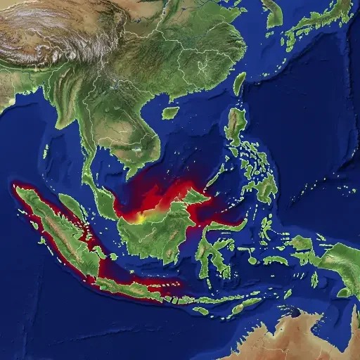

Katharina Seeger of the University of Cologne and Philip Minderhoud of Wageningen University analyzed 385 peer-reviewed studies on coastal vulnerability published over the past fifteen years. Their finding, published Wednesday in Nature, is disarmingly simple: 90 percent of those studies assumed the sea was lower than it actually is. The average underestimate was about 30 centimeters — roughly one foot. In Southeast Asia and parts of the Pacific, the gap reaches a full meter.
The error is not in how scientists project future sea level rise. Those projections — up to one meter by century’s end under high-emission scenarios — remain unchanged. What has shifted is the starting line. If the ocean is already a foot higher than the models assumed, then every impact timeline accelerates. Flooding, erosion, and saltwater intrusion arrive sooner than planned for. The question ceases to be abstract.
A Measurement Mismatch Baked Into Policy
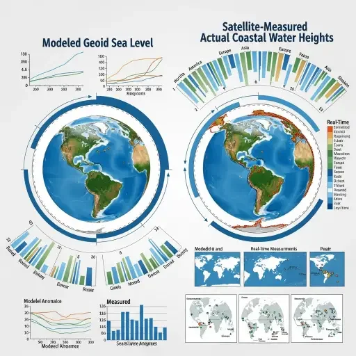
The cause is what Minderhoud calls a “methodological blind spot” between two systems of measurement that each work correctly in isolation but diverge where sea meets land. Most coastal hazard studies use a model based on the Earth’s gravitational field and rotation — called a geoid — to estimate sea level. That model works well for open-ocean measurements. But at the coastline, it does not account for tides, currents, wind, temperature, salinity, or phenomena like El Niño. Studies that calculate flooding risk typically set their baseline at the geoid’s zero line without checking it against actual measured water levels captured by satellites and tide gauges.
The result is a global systematic undercount. And it is not evenly distributed. Europe and the Atlantic coasts show smaller discrepancies. The Global South, the Pacific, and Southeast Asia — where the largest populations already face sea level risk — show the largest gaps. Climate justice, in other words, is also a measurement justice problem.
The IPCC Dependency Chain
Forty-six of the studies reviewed by Seeger and Minderhoud were cited in the most recent IPCC assessment reports — the documents that governments, insurers, infrastructure planners, and multilateral banks treat as the authoritative basis for climate-related capital allocation. If the baseline feeding those reports is wrong, the downstream policy built on them is mispriced. Coastal infrastructure budgets, insurance risk models, managed retreat timelines, and sovereign bond assessments for island nations all reference IPCC projections as their starting calibration.
Corrected calculations from the study suggest that a one-meter rise in relative sea levels would inundate 37 percent more land area and threaten between 77 million and 132 million more people than previous assessments indicated. Jonathan Bamber, director of the Bristol Glaciology Centre, described the results as having left him “genuinely surprised” — and he has worked on sea level rise for two decades.
Dissent and the Path Forward
Not everyone agrees on the magnitude of the implications. Gonéri Le Cozannet of the French geological survey argued that the problem, while real, is already understood within the field and that the authors may be overstating its impact on local planning. Robert Kopp, a sea level expert at Rutgers, noted that planners in high-risk areas like Vietnam often have accurate on-the-ground elevation data regardless of what global models assume.
These are reasonable caveats. But they apply to local practitioners, not to the global policy pipeline. The IPCC does not produce local flood maps — it produces the assessments that determine which regions receive climate adaptation funding and at what urgency level. If the inputs into that pipeline carry a systematic 30-centimeter bias, the outputs — however sophisticated the models layered on top — inherit the same error.
Seeger and Minderhoud have released corrected coastal elevation data for the entire world and published their full methodology. Whether the research community adopts the new baseline as standard practice will determine whether the next generation of climate assessments starts from where the water actually is — or where a gravitational model says it ought to be.
Tags
Related Articles
Sources
Seeger and Minderhoud (2026) in Nature, CNN climate reporting (March 4), CBS News science coverage, Associated Press via OPB and WSLS, Scientific Frontline summary, Bode Living analysis, NOAA Climate.gov sea level data